Friday, 2 October 2015

Gibbet Wood and Whittington, near Kinver

This is a very attractive 4 mile walk, just outside Kinver

The route starts along Gibbet Lane - the site of the last gibbeting in England. 

John Roberts aka William Howe, was convicted of shooting and killing Benjamin Roberts of Dunsley Hall (Then a manor house, now a  hotel). You can read some gruesome accounts by clicking here or here. There was no sign of this on the sunny day I walked here. (The wood is supposed to be haunted.)

The path has good views - this is Gibbet Wood stretching along the edge of the field  

I must look up what these flowers are: I thought they were loosestrife, but they aren't. Ideas, anyone?

The walk was noisy at times, with these four buzzards mewing overhead.

Just as the path reaches the road to the Round hill Works, the path turns off, across the entry road.

A fierce warning...

...but all the cattle were at the other end of the field

The next stile (all the stiles on this walk were tall - and some were quite difficult)

Don't normally see these on my walks. Possibly to stop horse riders?

Looking back to the path

The cattle were curious.

The path is quite easy to follow (this is looking back - Bunkers Hill Wood in the distance)

Looking over to Gibbet Wood

The path was impassable for about 50 metres just after this because of a leafy crop. I was checking path conditions*, so I waded through: it was shoulder high in places, and I was soaked in dew. It's best to wait until the spring for doing this walk!


Old hawthorn by the fence

An unexpected crop of sunflowers

The next part of the path is fine

It led to the Whittington Inn, currently being refurbished 

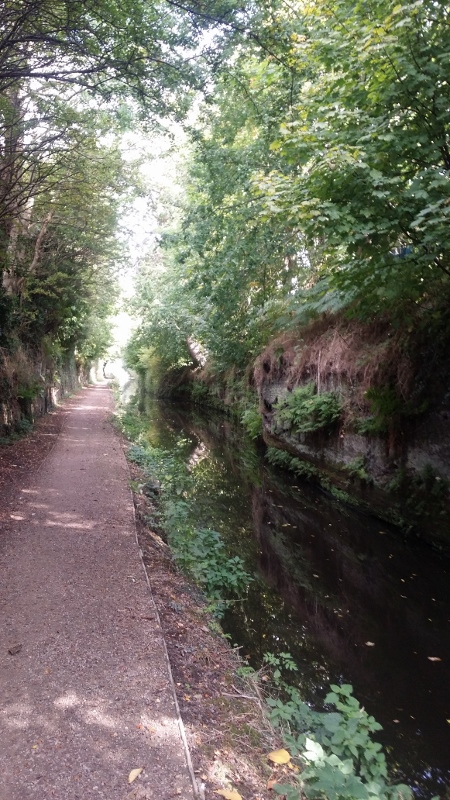
At the canal,I kept to the non-towpath side.

Colours are just starting to turn.

Two runners enjoying the sunshine
 Lots of moss among the trees

Beautiful canalside garden

Views over to Kinver edge as the path climbs 


Instead of going all the way to Kinver, I took this path

It keeps up high, giving views over to the Sheepwalks. 

The view ahead, taking me back to the start. 
Today's walk: Park at the entrance to Gibbet Lane - follow it (it's a path) until reaching the entrance to the Roundhill Works. Turn right here, follow the path across fields, and eventually back to the A449 near the Whittington Inn. Cross over and follow the path to the canal. Turn right, keeping on the side opposite the towpath, and where the canal turns, turn right uphill, following a path straight across to the A449 again. Cross over - then either follow the path opposite, (Rather overgrown and difficult, but not impossible)which leads back to Gibbet Lane, or walk along the side of the A449 to your start. Fantastic and varied views, but the path is quite hilly, and two sections are overgrown. One alomst impassable, so I can't recommend this at the moment. If all the paths were ok I'd give the walk 9/10.

* I did this as part of the Big Pathwatch. For details, click here

Mobile users, click here to see other walks. For computer users, the list is at the side of the page.

Tuesday, 29 September 2015

Oxley Two Canals walk - near Wolverhampton

I started this lovely walk at Oxley Moor Bridge, (WV10 6TX)


The rusty plaque explains that the previous bridge lasted for two centuries before being replaced, reminding me of the great age of our canals.

Oxley Boat Yard from the bridge

Turning into the Shropshire canal here, the traditional boat makes this look like an old scene.

I carried on along the Staffs and Worcs Canal - very green and rural, despite its proximity to Wolverhampton.
Marsh Lane Bridge

This section of canal is only one boat wide. Cut out of sandstone, it's known as Pendeford Rockin',* (or sometimes, the Narrows) and runs for almost half a mile, with two passing places.

The colours are not really autumnal yet.

On one side is a large nature reserve

The canal goes under the M54...

...but soon returns to being rural


At Coven Heath Bridge, I left the canal, aiming to follow the Monarch's Way across country to join the Shropshire Union Canal.

The Monarch's Way signs are tiny, but easy enough to follow.

I turned left onto this lane for about 1/4 mile, ..

...and then turned on to this bridle way (Monarch's Way sign visible)


The bridleway goes for quite a long way.

I liked this sign "This way". Saves time deciding what to do!


Back to the M54. This time over the top.

The bridleway eventually arrived at Pendeford Caravan Park, once the site of Pendeford Hall.

A short walk along Pendeford Mill Lane,...

...and I was back on a canal. This time the Shropshire Union.

I sat here to have my lunch. Perhaps the site of an old bridge?

Then under the newer bridge

Past Wolverhampton Boat Club 

Again, the canal is very rural.

There are paths on both sides.

For late September, the weather was glorious

The hopeful ducks were soon disappointed; I had nothing to feed them with.
Reflections

Coming up to Autherley Junction, where the Shropshire Union meets the Staffs and Worcs.

The bridge lifts to allow boats into the work area. 

There's a great shop - coffee and ice cream, as well as souvenirs.

The old toll house, handily placed to catch boats starting up "the Shroppie"

This is a stop lock, with barely a rise. It was there to slow boats down, and to stop the Shropshire canal using too much water from the Staffs and Worcs.
This was a good walk. 7 miles in total. Recommended, and easy to follow. Would be even better in a few weeks with more autumn colours .

* three sources put this as the name of this cutting, but a fourth source says that this is the name of the narrow section on the Shropshire Union canal. I've gone with the majority.

Today's walk: Start at Oxley Moor Bridge, and follow the Staffs and Worcs until the next bridge after the motorway. Turn left, following small but distinct Monarch's Way signs along a lane. After 1/4 mile turn left onto a bridleway. Follow this this for 1.25 miles until the Pendeford Caravan park. Turn left onto the road, and right at the junction, on the Wobaston/Pendeford Mill Road. After about half a mile, the road crosses the canal.Turn left onto the canal and follow the canal (Shropshire Union) back to your starting point. Coffee and icecream, at Autherley Junction,just before the walk ends. 7 miles

Clickthe links below for other walks in in the Wolverhampton area;
Compton canal walk
Wombourne to Oaken

Mobile users: To see other walks in the Black Country, click here. If you're viewing on a computer, it's the menu at the side.